Alps Crossing
Our journey hiking the E-5 trail from Oberstdorf to Merano.
8 days - 140 km - 6700 m elevation gain
Timeline
This is the timeline of our trip.
Click on the link below the map to check out the route for each day on Komoot.
Photos will be added to the albums as soon as possible!
Day -2
Drive to Merano
Lisa the (truck) driver
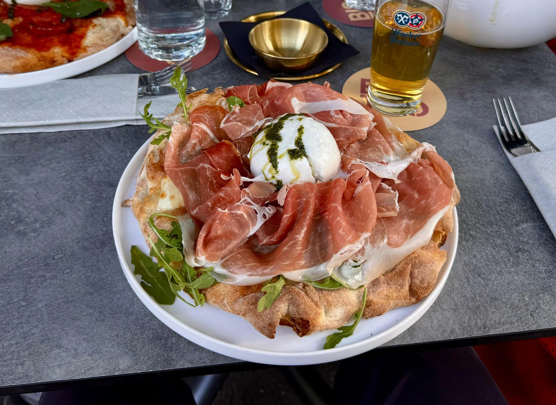
To beat the crowds on the Fern Pass and travel in comfort, we decided to leave at night. We set off at 2:15 a.m. and first picked up Laura. After a smooth start to the trip, we finally stopped halfway in Illertal for our first break. Even though it was actually my turn to drive, Lisa said she could - and wanted to - drive even further because she was determined to drive the Fern Pass herself. If Lisa ever searches a new job, she could work as a truck driver because she drove for 8.5 hours without any trouble. In the end, I drove the last stretch through the mountains to our final destination, Merano. At the hotel, my Chinese language skills came in handy because the Chinese owners didn’t speak German or English, and my Italian doesn’t go beyond “Buongiorno,” “Grazie Mille,” and “Arrivederci.” Of course, as always, they were completely surprised. After a pizza by the river, we went to bed early because we had quite a bit of sleep to catch up on.
Day -1
Merano to Oberstdorf
To the Start
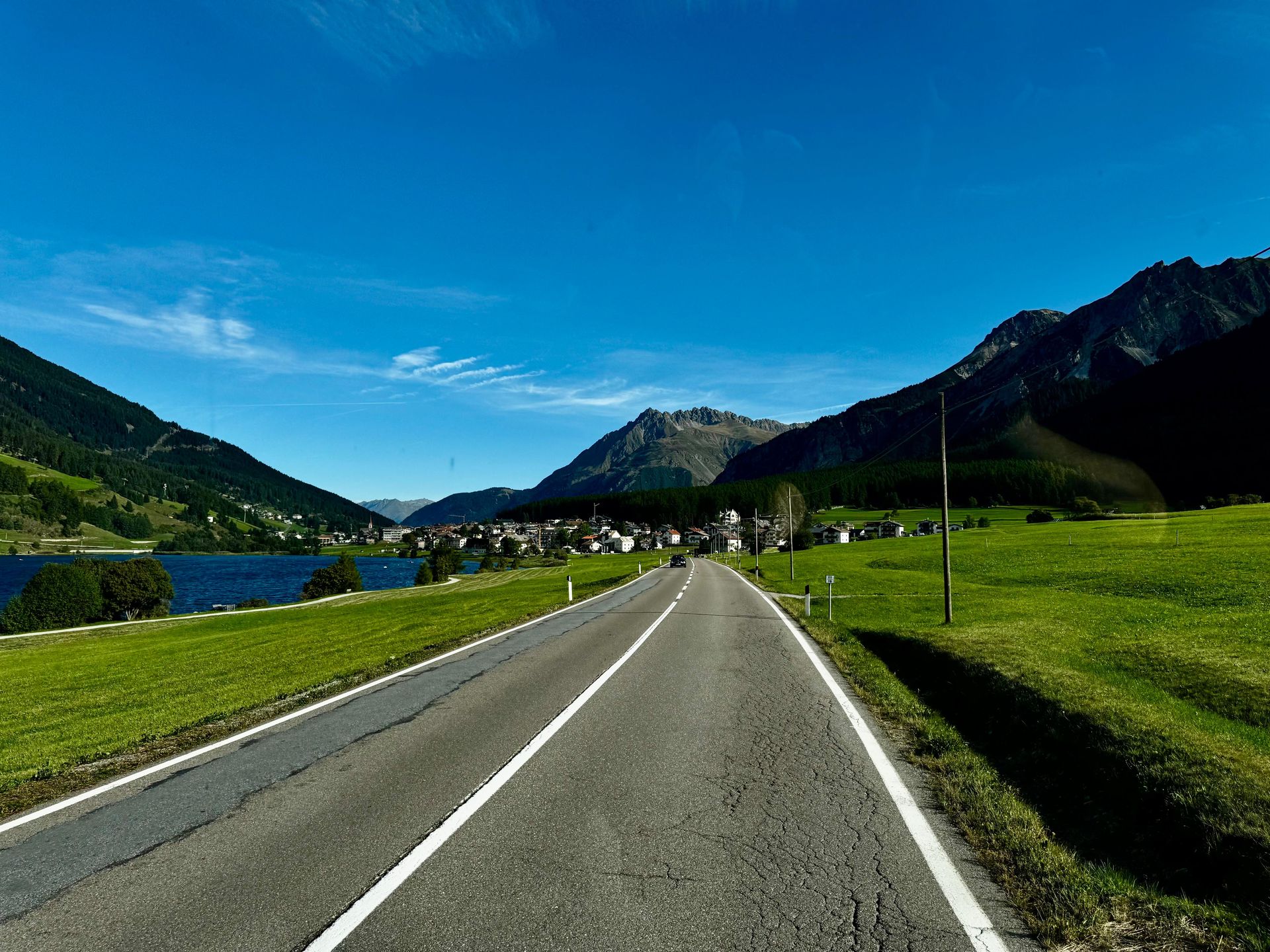
Today we had to be at the station by 8:00 a.m. for the bus that would take us from Merano to Oberstdorf. Normally, people park their cars in Oberstdorf, walk the route to Merano, and then take this bus back to their cars. We chose to do it the other way around by driving the car to the finish line and walking back to the car so we wouldn’t have to spend another 5 hours on the bus at the end. While Lisa and Laura were sitting somewhere in the back of the bus, the driver let me sit in the front passenger seat, giving me a great view during the ride through the Alps. After arriving in Oberstdorf, we checked in right away and played mini-golf. Then schnitzel #1 with a generous ice cream sundae was on the menu. After all, we needed plenty of energy for the next day 😉
Day 1
Oberstdorf to Holzgau
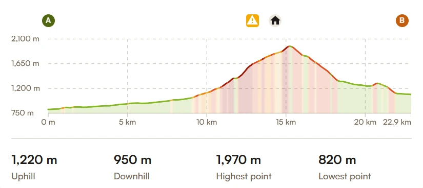
↔️ 22,9 km
↗️ 1220 m
↘️ 950 m

Here we go!
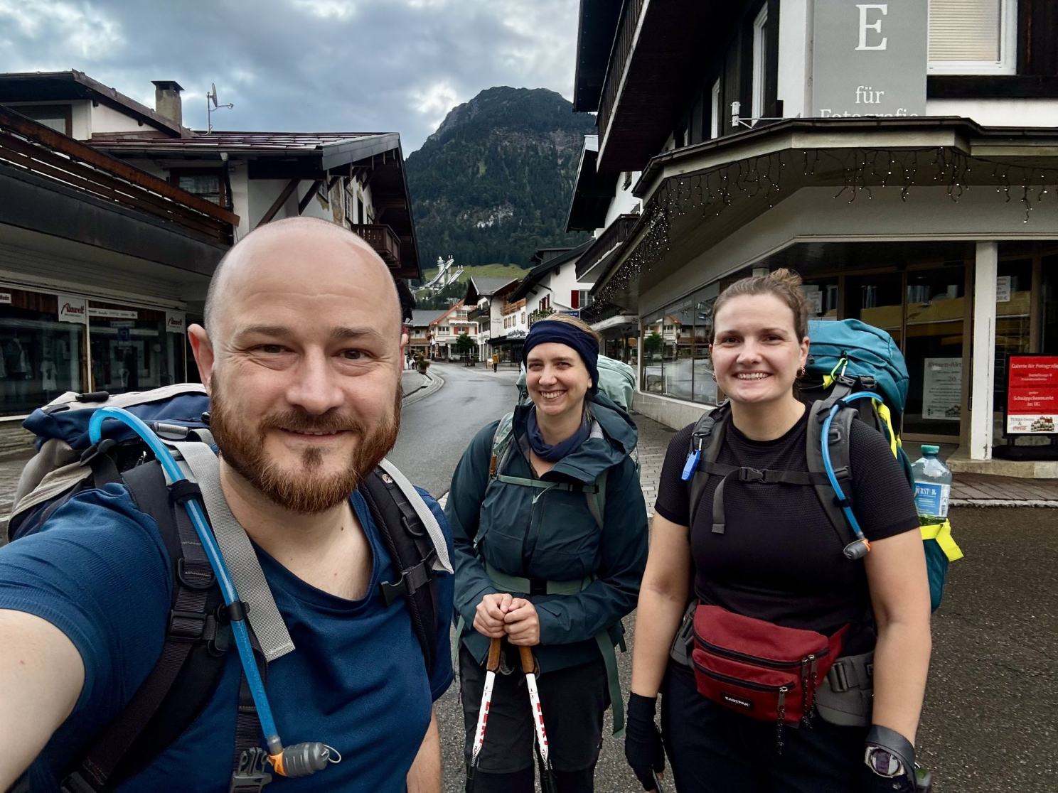
At 7:00 a.m. on Monday morning, we were outside, ready to start our adventure. First, we stopped by the bakery for breakfast, lunch, and coffee. While people usually take a bus to Spielmannsau (the last bus stop), we decided to walk this 8-kilometer stretch as a “warm-up” and then have breakfast there.
Then the real work began. About 6 km and 900 meters of elevation gain later, we arrived at the Kemptener Hütte. Here we had a good lunch and were able to rest a bit before crossing the mountain toward the valley. Whereas people usually stay overnight at the hut, we chose to spend most of our nights in the valley. This meant we had to tack on another 8 km and a 750-meter descent to reach our first lodging in Holzgau. Here, schnitzel #2 was on the menu, and after 40,000 steps, the bathtub in Laura’s room was a welcome treat.
Day 2
Holzgau - Memminger Hütte
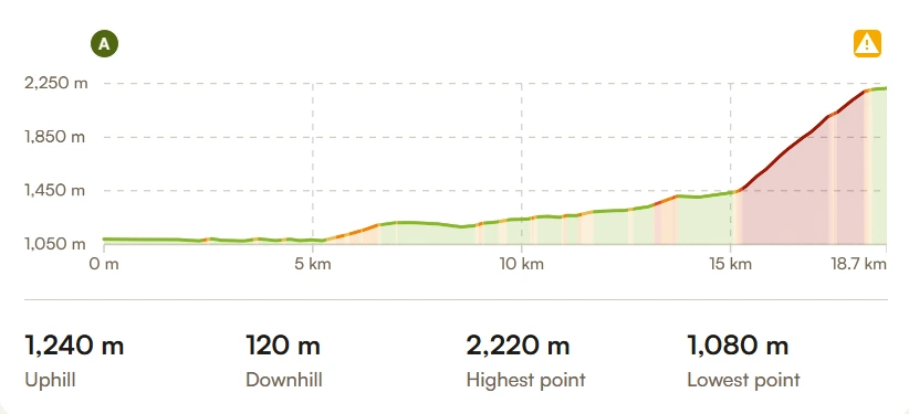
↔️ 18,7 km
↗️ 1240 m
↘️ 120 m

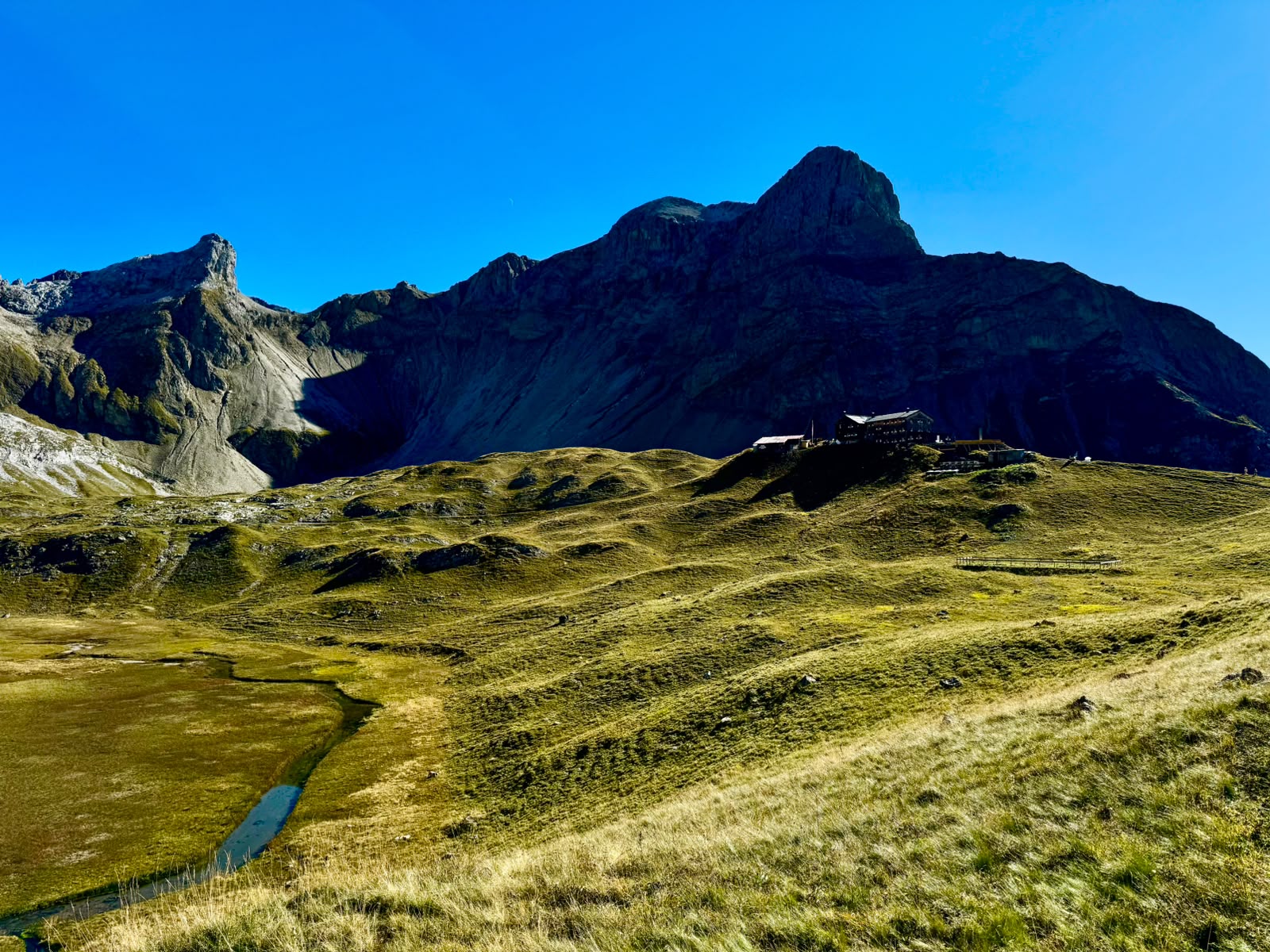
Memminger Hütte
Despite the grueling first day, we were relatively well-rested for the next challenging day. Once again, we chose to walk the 15-kilometer stretch from the valley to the last bus stop. There was also a cable car there where we could send our backpacks to the Memminger Hütte. Since the climb of about 800 meters in elevation over a distance of 3 kilometers (30% grade!) on top of the previous 15 kilometers would be tough, we gratefully took advantage of this option. Once we arrived at the hut, it was crowded but the atmosphere was great. Even though we had half-board, we couldn’t resist diving right into the Kaiserschmarrn. The final menu was a hearty meal: spinach curry soup as a starter, leberkäse with mashed potatoes and peas and carrots as the main course, and yogurt parfait for dessert. The hut’s “ruhezeit” was 10:00 p.m., but we were already in bed long before that. Falling asleep and staying asleep, however, turned out to be a challenge…
Day 3
Memminger Hütte - Zams
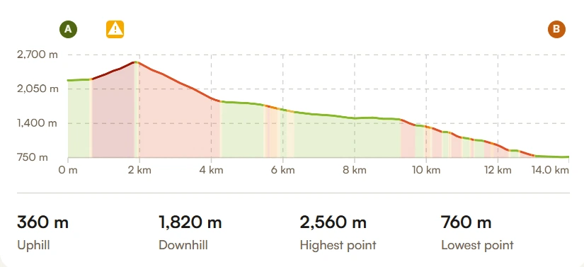
↔️ 14,0 km
↗️ 360 m
↘️ 1820 m

She said yes!
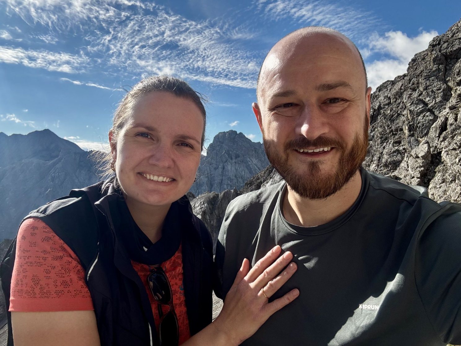
We woke up exhausted at the Memminger Hütte. For us, it was just one night—purely for the experience. Thank goodness, because sharing a room with 12 people turned out to be a bit of a stroke of luck compared to the large dormitory with about 60 beds. (Which everyone also had to walk through to get to the bathroom, etc.) After a hearty breakfast, we set off and immediately got to work with a climb of about 400 meters in elevation over rocky terrain. What was planned after reaching the ridge was known to Laura and me, but a complete surprise for Lisa.
That’s where I decided to propose to Lisa. She didn’t see it coming at all, but once the initial surprise had settled, she said “yes” with conviction. For us, the Seescharte—a peak nearly 2,600 meters high—will always hold a special place in our hearts. The people who had crossed the ridge in the meantime started cheering and clapping, which made the moment even more beautiful. I’d also like to extend a big thank you to Laura for slyly finding out Lisa’s ring size during a training hike!
After a very long descent, we finally arrived in Zams. Here we enjoyed a delicious meal at the hotel, and the owner’s “father-in-law” sent us some sparkling wine to our table. He felt it was part of the experience. At least, that’s how I understood it, since he was very hard to understand with his thick Austrian accent. It was, of course, very sweet of him!
Day 4
Zams - Wenns
↔️ 12,5 km
↗️ 340 m
↘️ 1510 m
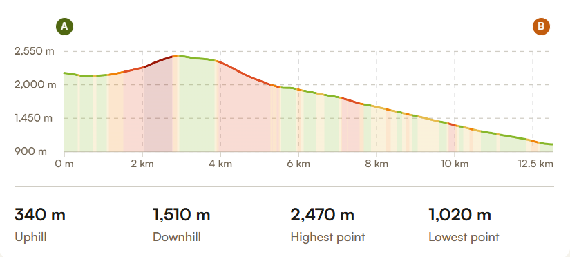

By Cable Car
After two intense days, it was wonderful to wake up in a modern and clean hotel. The breakfast buffet was also very good. After breakfast, we walked to the shuttle bus that took us to the cable car station. From there, we took the cable car up to the Venet Gipfelhütte. On the mountain, we ran into the “Nüssers” (a group of men from Neuss who are hiking virtually the same E5 route) again, and we hiked most of the way together with them. Since we were at an altitude of about 2,500 meters, we occasionally found ourselves in the clouds but always made it back out into the sun. After a delicious cheese spaetzle for lunch at the Larcher Alm, we continued our descent to our hotel in Wenns. In the evening, it was time for schnitzel #3, this time with a cream sauce.
Day 5
Wenns - Köfels
↔️ 24,8 km
↗️ 940 m
↘️ 430 m
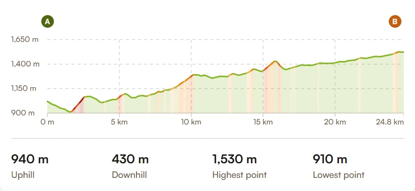

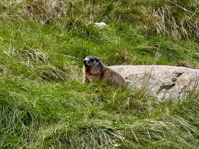
Marmots!
Since today’s itinerary included a relatively uninteresting but long route through the valley, we figured it would be better to save our energy and effort and take the bus. This allowed us to sleep in a little longer and take our time going to the supermarket to stock up on groceries, since the town where we’re staying today doesn’t have any restaurants. Unfortunately, the bus was packed, hot, and the driver was driving like a race car driver, so all three of us were completely queasy by the time we finally got off the bus. After we’d recovered, we headed back to St. Leonard (this time on a more peaceful bus ride) to see the ibex and marmots. We spent the rest of the day relaxing in the apartment.
Day 6
Köfels - Mandarfen
↔️ 4,97 km
↗️ 160 m
↘️ 10 m
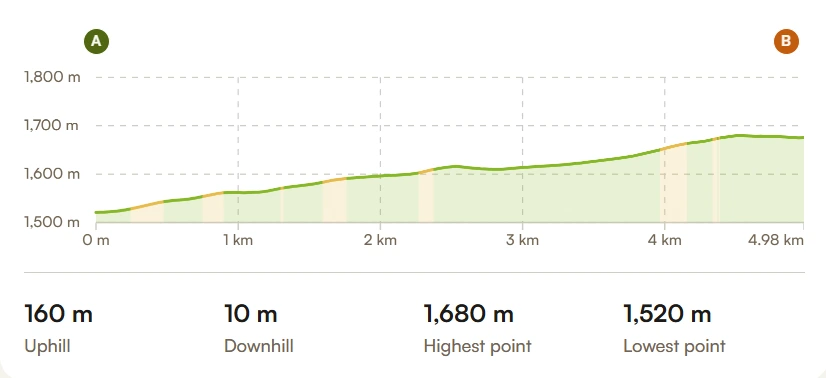

Relax!
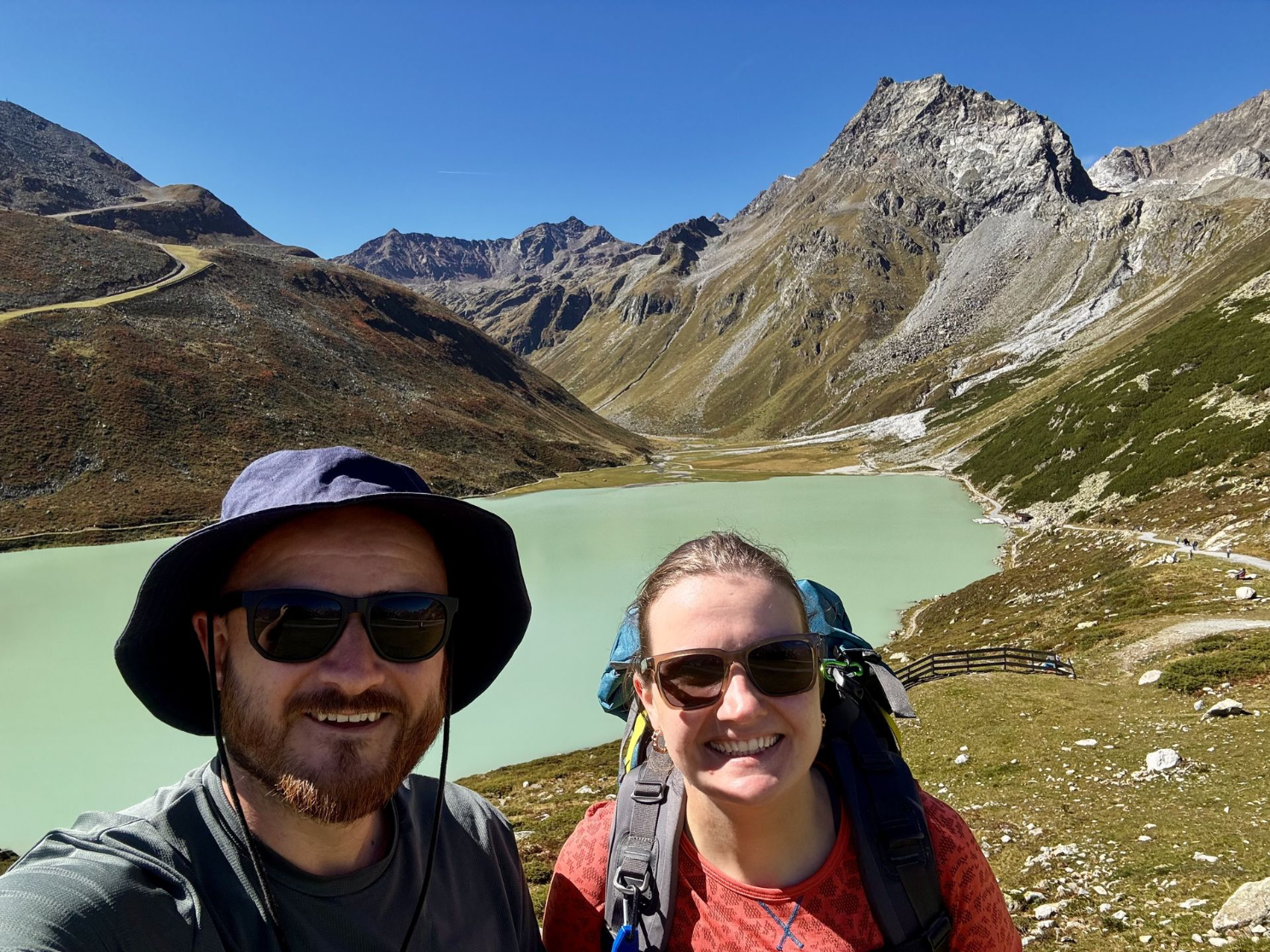
Today we had breakfast at the apartment first and then walked to Mandarfen. It was only a short 5-km walk, but the weather was lovely, so it was a nice morning walk. After we arrived, we were able to check in right away and went to Intersport to buy a knee brace. Even though the entire Alpine crossing has been relatively easy on my stamina so far, my left knee has unfortunately started to hurt over the last few days on flat sections with a slight downhill slope. By the end of the day, I had to hobble downhill like a pirate with a wooden leg every time, because bending my knee was painful.
After a quick stop at the supermarket, we took the cable car up the mountain to visit the Rifflsee. There, we walked around the lake and had a leisurely lunch. Finally, toward the end of the afternoon, we visited the hotel’s spa facilities, and for dinner, Lisa really wanted Kaisersmarrn again, but unfortunately, almost all the restaurants were closed. Probably because it was the off-season between summer and winter, so we ended up having a tasty pizza at the place next door.
Day 7
Mandarfen - Vent
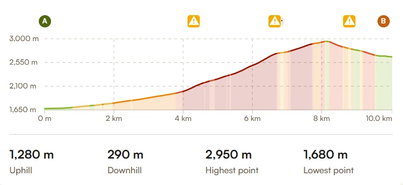
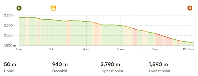
↔️ 20,3 km
↗️ 1330 m
↘️ 1230 m

Ötzi is a funny guy
Today’s itinerary included a challenging climbing stage. After yesterday, it took a little while to get going, but the relatively flat start helped us wake up. Once we arrived at the Gletscherstube, we found that the cable car was available again, so we gratefully took advantage of it to send our backpacks up ahead. After that, it was a 900-meter climb to the Braunschweiger Hütte. The entire stretch was quite rocky with narrow trails running right alongside precipices, so this really felt like mountain climbing to me. Along the way, I ran into a man from Nepal. His name was Machindra, and he’s a cook at the hut. He was on his way down to the valley to spend his three days off with friends. After a brief chat, we exchanged phone numbers, and he continued on his way—only to call me back because he had a gift for me: green tea from Nepal, packaged in a very nice pouch. Now that was a nice surprise!
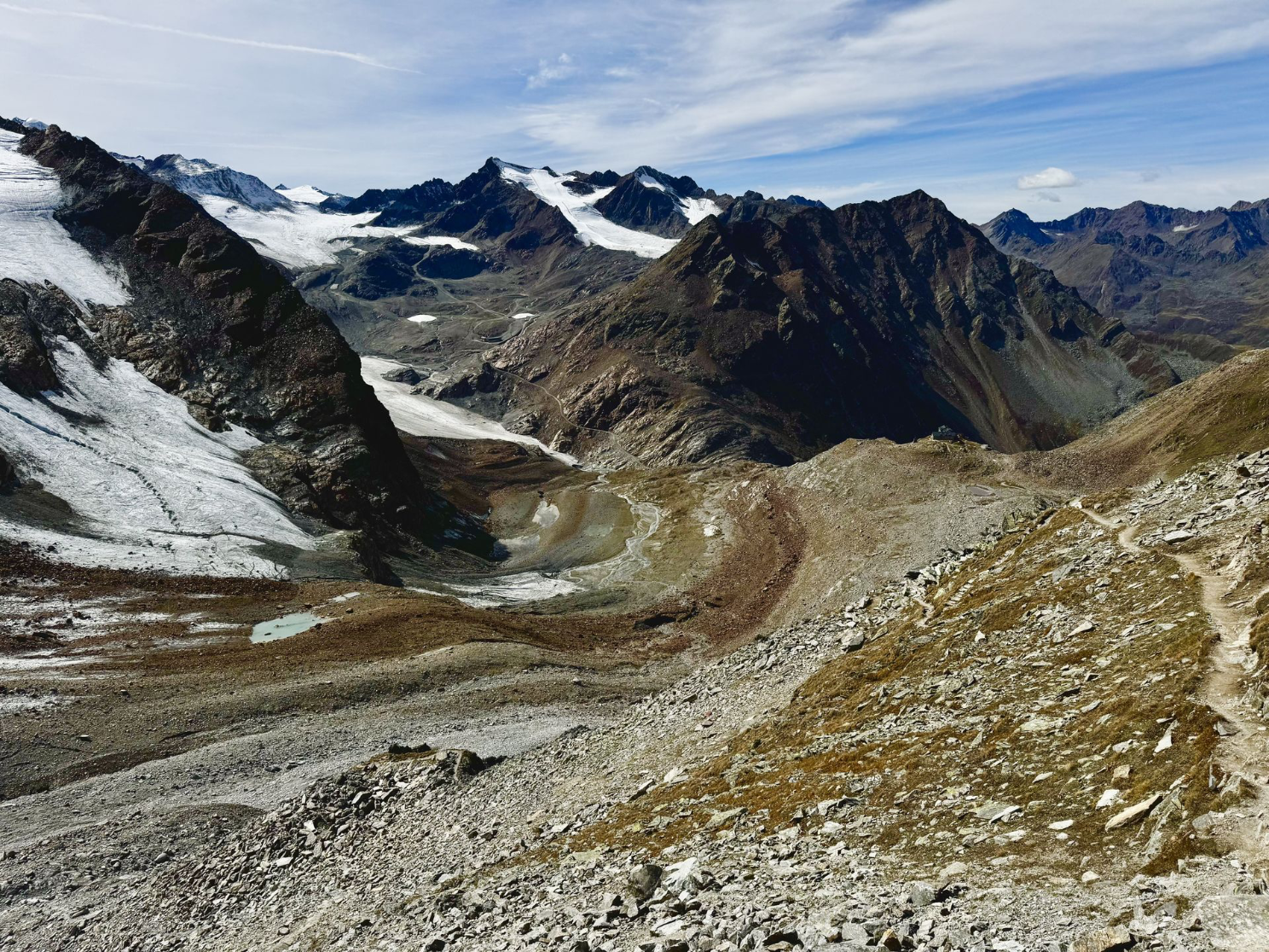
After a hearty lunch at the Braunschweiger Hütte, we had to continue on, but since our backpacks hadn’t arrived yet, we had to wait. Mountain huts often wait for several people who want to have their backpacks sent up. When that wasn’t the case, they brought our backpacks up anyway. The section from the hut to the Schwarze Schnee cable car was even rockier and also had several sections with cable railings you could hold onto while climbing. In the end, we reached exactly 3,000 meters. Since the delay with the backpacks left us without enough time for the second part of the route, we took the cable car down to the Rettenbach Glacier and then took the bus via Sölden to Vent in the Ötztal. Tomorrow, we’ll also walk past the site where Ötzi was found.
Day 8
Vent - Vernagt
Take the bus to Merano
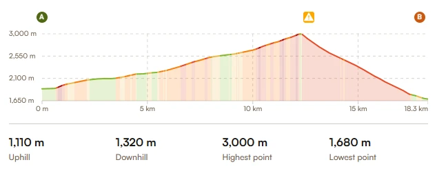
↔️ 18,3 km
↗️ 1110 m
↘️ 1320 m

A Test of Character
It was time for the final leg, which was going to be especially nerve-wracking because of the physical problems that had started to surface after 7 days. The knee was taken care of with the brace, but last night we discovered two massive blisters on (or around?) my little toes. Since one had already burst, we decided to remove the skin, apply Compeed patches, and wrap brown tape around them. Then there was the biggest problem: my left ankle. It had been getting more painful by the day, and today it was worse than ever. Against my better judgment, I decided to have Laura tape it and rely on a steady supply of ibuprofen and acetaminophen because I was determined to walk the last day. After a hearty breakfast, we set off.
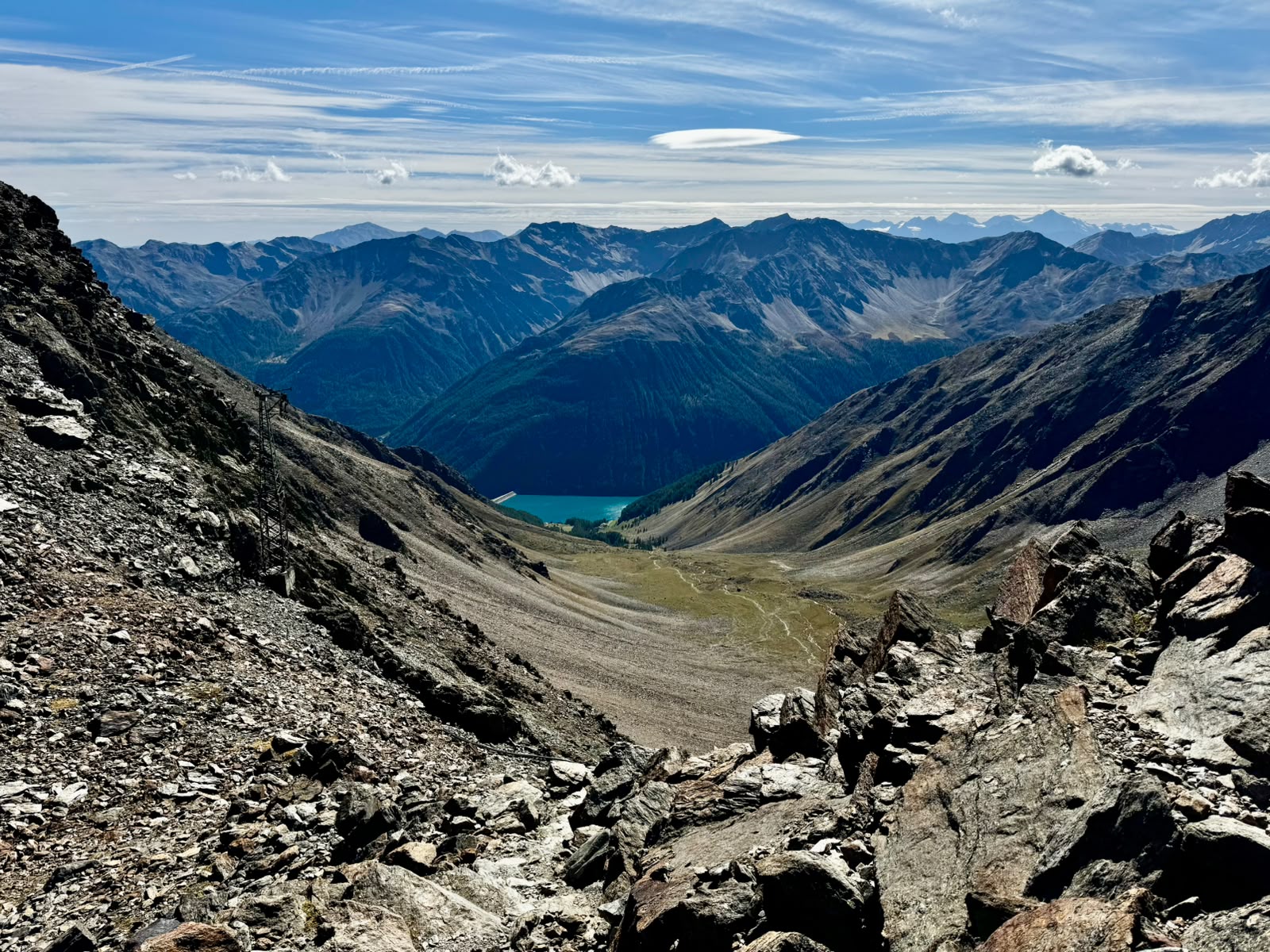
After a few kilometers and an ascent of about 600 meters, we arrived at the Martin Busch Hütte. It was already closed, and construction workers were busy at work there with the help of the helicopter that had flown past us several times along the way, carrying building materials. It was interesting to see that they also use a helicopter as a construction crane in the mountains. We had a quick bite to eat to replenish our energy reserves and then continued on. Halfway to the summit, we considered taking the 1.5-hour detour to visit the site where Ötzi was found, but given the condition of my ankle, we decided to hike directly to the Similaun Hütte. Since it’s located on Italian territory, it seemed fitting to have spaghetti Bolognese for lunch there. At an altitude of 3,020 meters, we could already see our destination—the Vernago reservoir—from here. The descent turned out to be much longer than planned, likely because the pain had significantly slowed me down. It was, however, really nice to see several wild marmots along the way. Finally, at 6:00 p.m., we arrived at the bus stop, and our Alpine crossing was complete. Now it was just over an hour by bus to Merano.
Day 9
Merano